


Great Britain 3D Printed Topological Map Hand Painted and Framed - Small
from £12.00
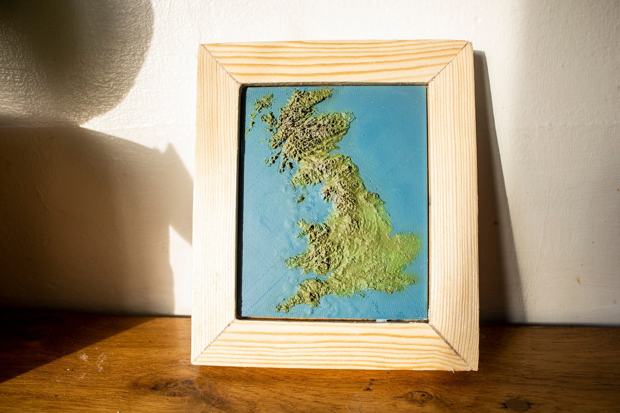
Why not pay tribute to our island nation with this 3D printed topological map of Great Britain. This one of our small maps is perfect for a shelf or mantlepiece the item measuring 12.5 cm by 10 cm (not including the rustic frame). The scale converts 1 cm to around 75 miles - the Isle of Man being around 30 miles long while appearing on this map at around 4mm. This piece includes most of Great Britain - squeezing in the Western Isles but not Orkney and Shetland.
The Z-axis has been scaled up by around 24 times to highlight the geographical details in all their glory. Many areas are visible including the Lakes, Peaks, and the Island's various Wolds. We hope our map captures some of the beauty of this green and pleasant land.
You can purchase this map as a basic single colour 3d model, a great paint your own gift. Alternatively, you can purchase the painted version frame or unframed.
All our maps and frames are hand made by an artist - the frames are hand-cut from recycled wood offcuts for a rustic feel, and varnished. We use images from satellite maps to guide us as we paint each hill and vale by hand. Actual geographical data provided by various space missions - (particularly Japan's ALOS mission) - as well as sonar, radar, and LiDAR submissions, help form a complete map of Earth's surface, from which we source and translate the data for our 3D map models. This particular map took more than 6 hours to print and we think it was well worth the wait!
Delivery is with Royalmail as this is a smaller item.
Finish:
Quantity: