Mount Snowdon (Yr Wyddfa) 3D Printed Topography Relief Map – Mini Map (Colour PLA)
from £12.00
Mount Snowdon also known as Yr Wyddfa, is the highest mountain in Wales standing around 1085 meters tall - the 3rd tallest mountain in the British Isles - and is situated around 10 miles South East of Anglesey. It was used by Edmund Hillary while training for his ascent of Mount Everest, but easier routes such as the summer running railway allow for less experienced mountaineers to enjoy the views from the summit.
Perhaps you've taken a leisurely, or an arduous climb to the top. Maybe visiting the place is on your to-do list for next summer. Whatever your attachment to this beautiful and dramatic part of the world, you can now own a scientifically accurate model of this Welsh mountain.
The Z-axis relief is multiplied by 3 times to allow the geological features to stand out in all their glory. This map covers about 7 miles squared and is available in small (10cm by 10 cm) or medium (15 cm by 15 cm) prints. The map is printed to a layer height of 0.1mm to capture as much detail as possible!
You can now display some of Earth’s most famous geological features in your own home with our Mini Map Series. Based on actual geological data, our wonderfully detailed 3D printed topology maps are perfect for your desk, shelf, or mantelpiece. Designed and printed here at Chapel Prints, hand finish and digitally painted so each model looks as realistic as possible.
All our maps are design and finished by an artist. We use images from satellite maps to guide us as we paint each hill and vale by hand. Actual geographical data provided by various space missions - (particularly Japan's ALOS mission) - as well as sonar, radar, and LiDAR submissions, help form a complete map of Earth's surface, from which we source and translate the data for our 3D map models. This particular map (the small 10 cm squared version) took more than 8 hours to print but we think it was well worth the wait!

 Image 1 of 5
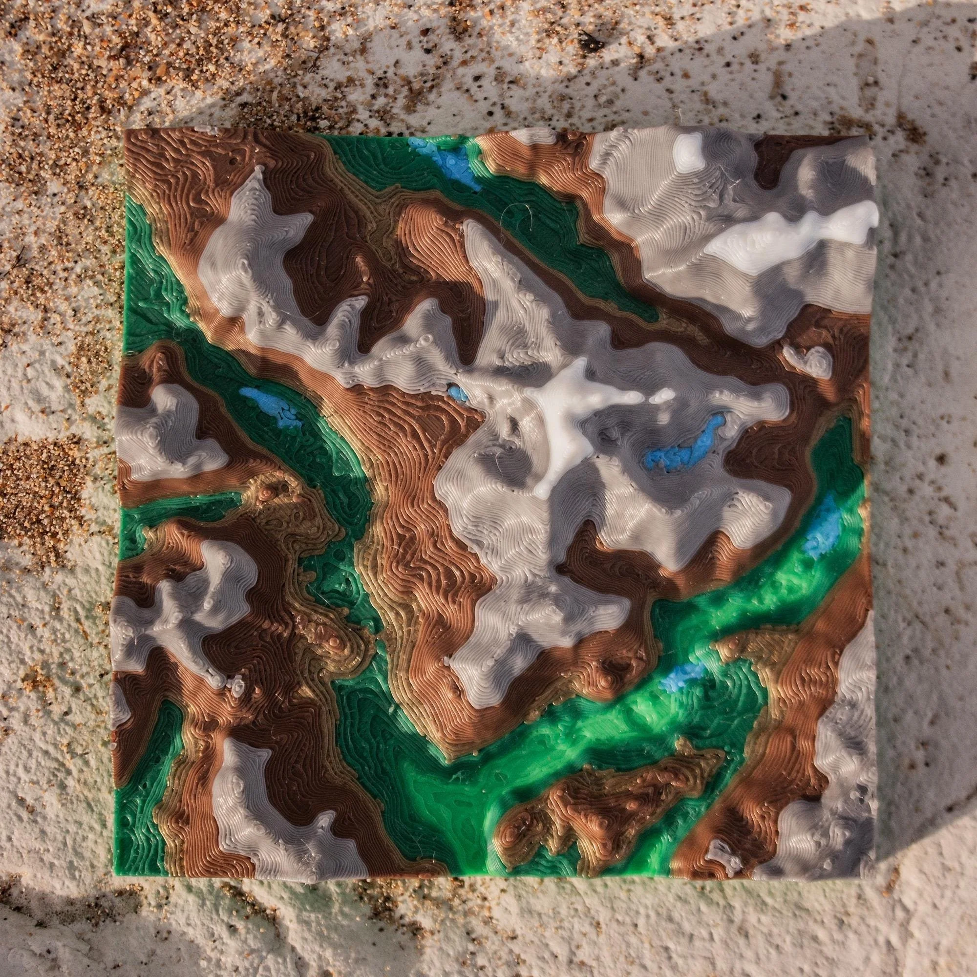 Image 2 of 5
 Image 3 of 5
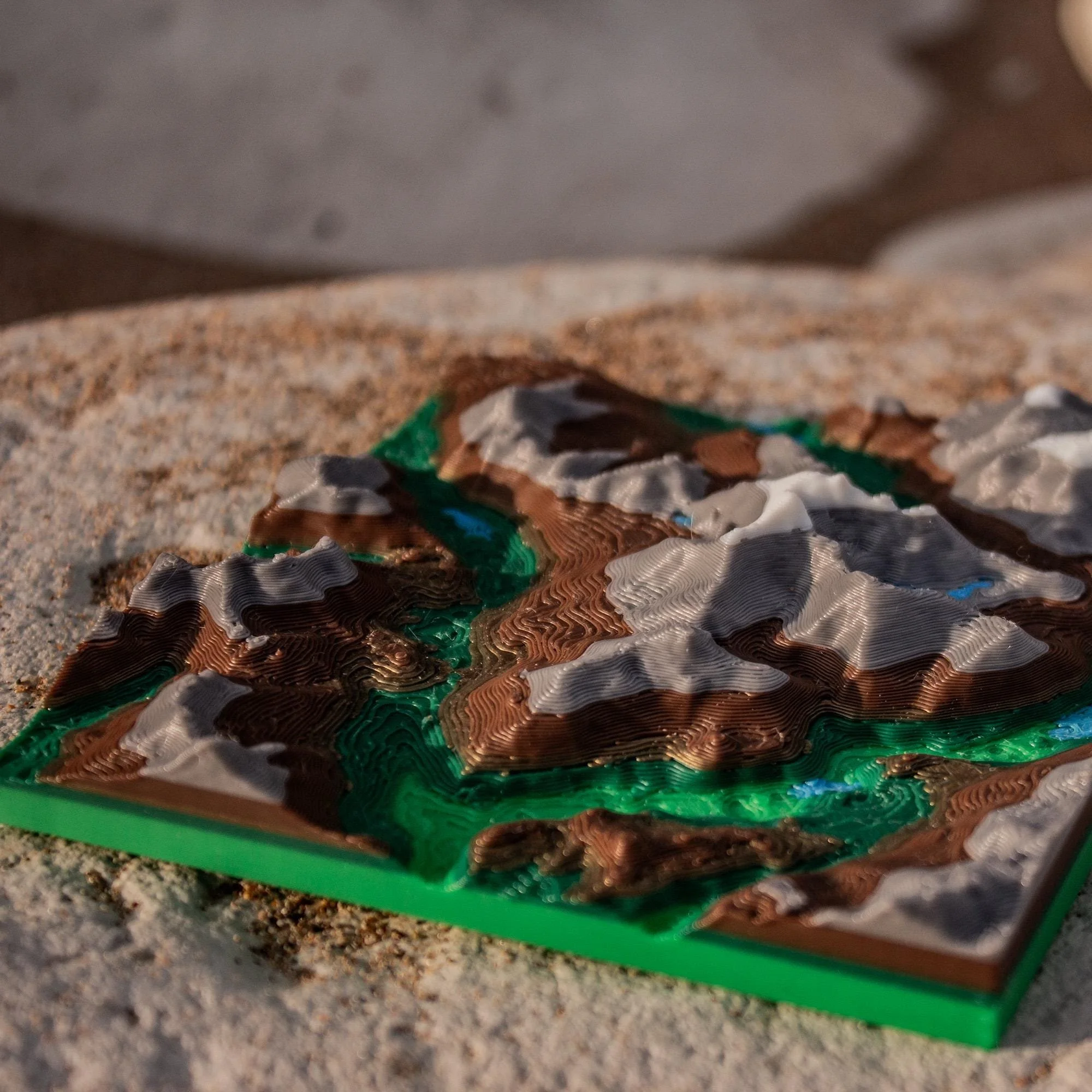 Image 4 of 5
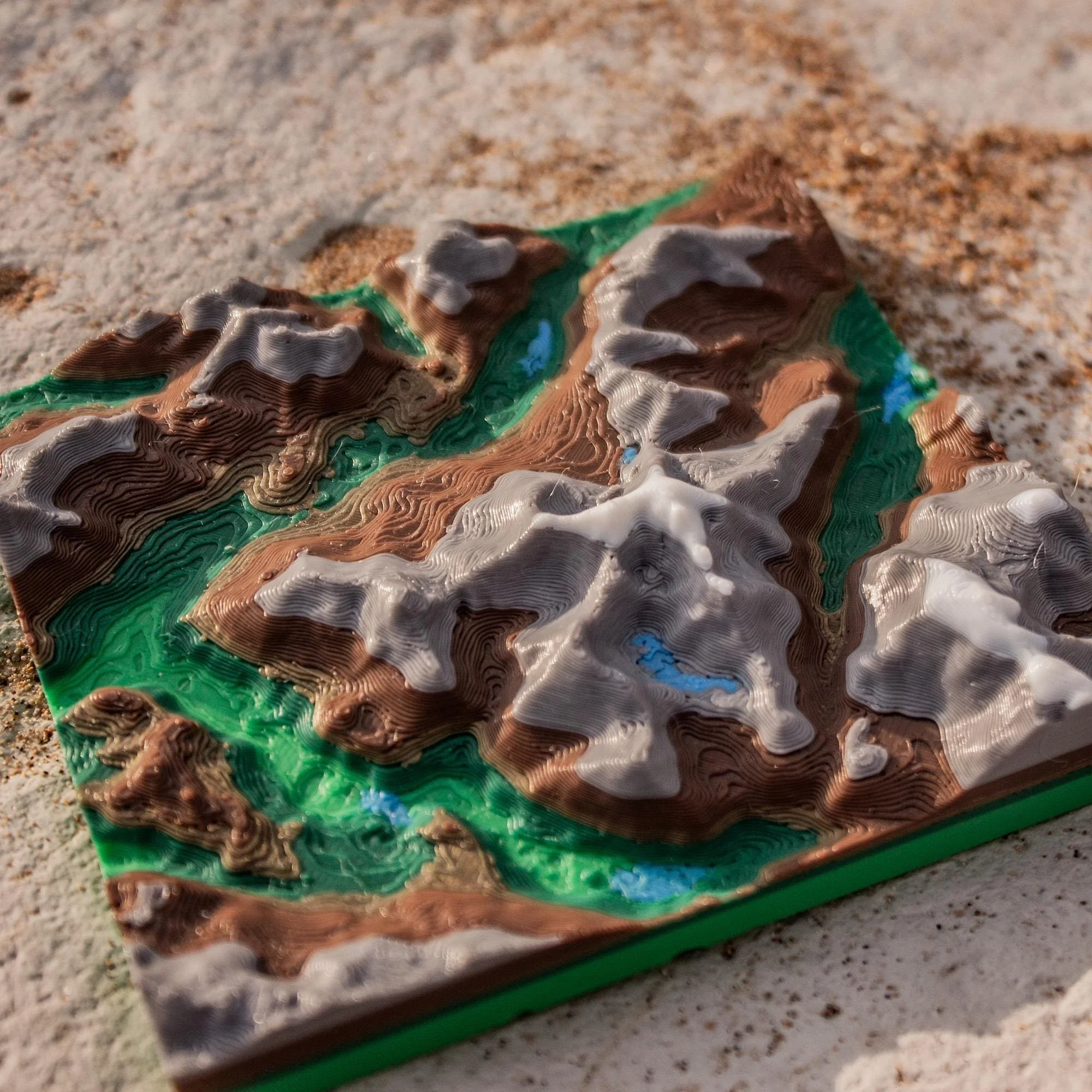 Image 5 of 5